Day 1: flight to Lukla (9,184′), hike to Phakding (8,698′)
We shouldered our familiar backpacks at 4:30am and walked into the strangely quiet streets of Kathmandu. It was still dark when the taxi dropped us off at the airport terminal for domestic flights, a shell of a building still under construction.
Not knowing what to expect from our Nepali flight time, we showed up a little before 6am our 7:30am flight. Without delay we were rushed through “security,” given a boarding pass, pointed to a bus, shuttled to the runway and hustled onto the 12-passenger plane. We took off at 6am. It was like finding yourself in the seat of a roller coaster you weren’t sure you wanted to ride when you thought you were stepping in line.


It was slightly disorienting to go from Kathmandu to the Khumbu so quickly. On the Annapurna circuit we hiked for days before we saw any big peaks. Now, we found ourselves instantly transported and surrounded by them. We warmed up in a lodge with breakfast, put on a few more (all?) layers, then hit the trail.


It was a familiar relief to be back on the trail, stopping for dal baht, and sipping lemon tea. We made it to Phakding by early afternoon, found a room and settled into our guesthouse.
Day 2: Phakding (8,698′) to Namche Bazar ( 11,283′)
The second day’s hike was much more challenging. Michelle was battling a head cold she picked up in Kathmandu and the steep trail and altitude weren’t helping. Together, we pushed through the herds of trekking tourists, expedition parties, lines of yaks carrying supplies, and across airy suspension bridges as we climbed to Namche.


The Solukhumbu region of Nepal holds perhaps the highest concentration of breathtaking high peaks in the Himalaya. It certainly holds the most renowned summits: Everest, Nuptse, Lohtse, Amadablam, Cho Oyu, Cholaste, Makalu. These mountains have, over the course of many centuries, carved, shaped, and hardened the people who call the Khumbu home. The Sherpa culture is most apparently on display in Namche, the trading center and heart of the Khumbu region.
We took a rest day in Namche to acclimatize and during our two days there we were able to see a movie about Sherpas: the Heros of Everest, visit a Sherpa cultural museum, a Khumbu regional visitors museum, and a local school. It was enlightening and inspiring to learn about the special people and place we were visiting. It is worth noting the incredible contributions that the Sir Edmund Hillary Foundation has made to the region. The man who made his name and fame as the first to summit Everest, alongside Tenzing Sherpa, became a true steward of the Solukhumbu. We left Namche humbled and with a profound respect for the Sherpa people.


Day 4: Namche ( 11,283′) to Thame (12,467′)
We left Namche also with an humbling respect for the environment we were entering. After the tragedy on Thorong La, we were very weary of the poor weather in the forecast. A new cyclone had hit land on the eastern coast of India and the Nepali authorities were quick to warn trekkers after the blame the received in recent weeks. We asked ourselves some difficult questions and were open to changing the goals of our trek. However, we checked the forecast on our iPhones the morning we left, the cyclone was weakening and we felt the threat was manageable.

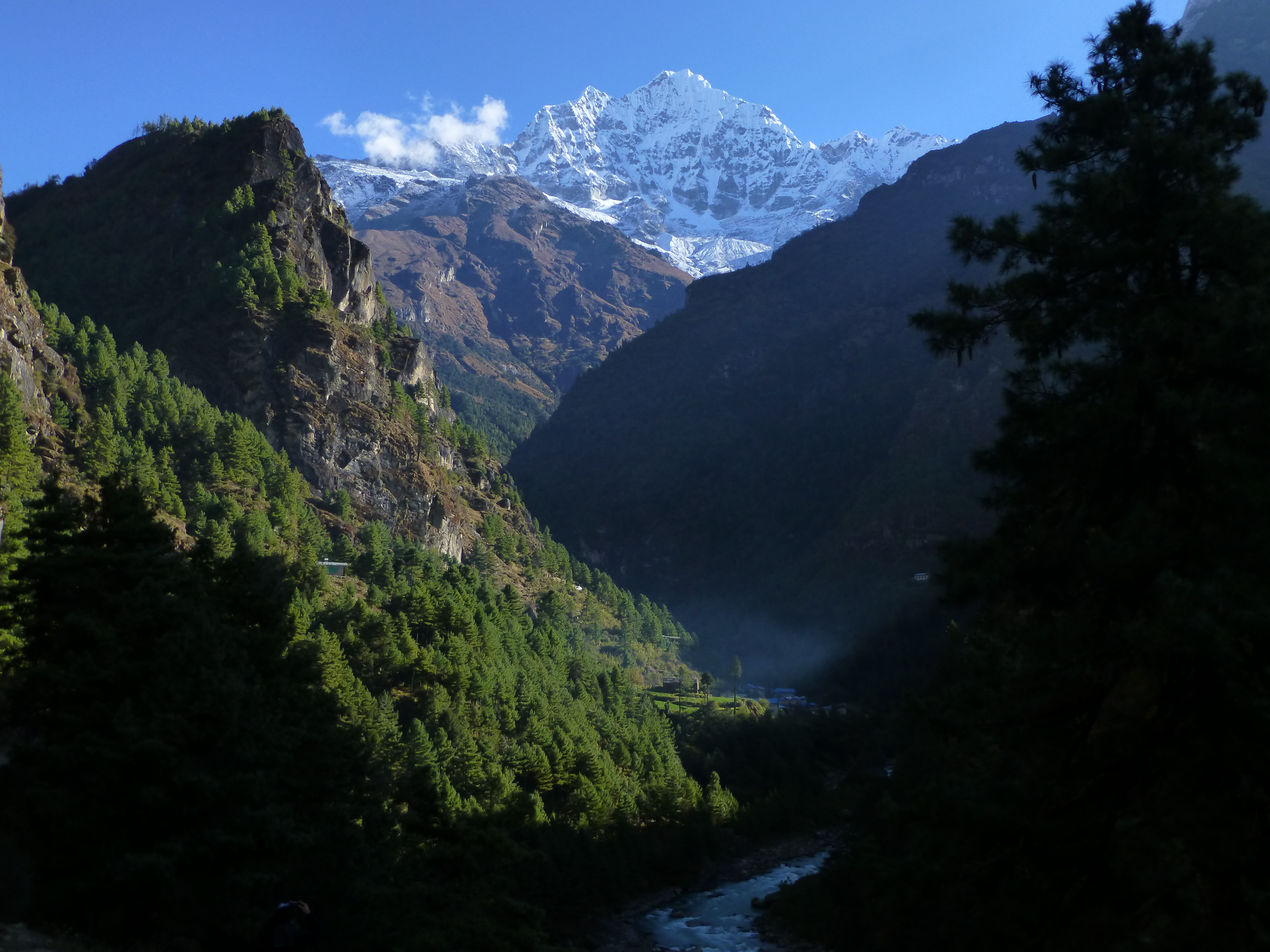
We hiked to Thame under beautiful blue skies and left behind the crowds headed to Everest basecamp. We would rejoin those crowds again eventually, but not before we tackled our first major mountain pass of the three passes trek.


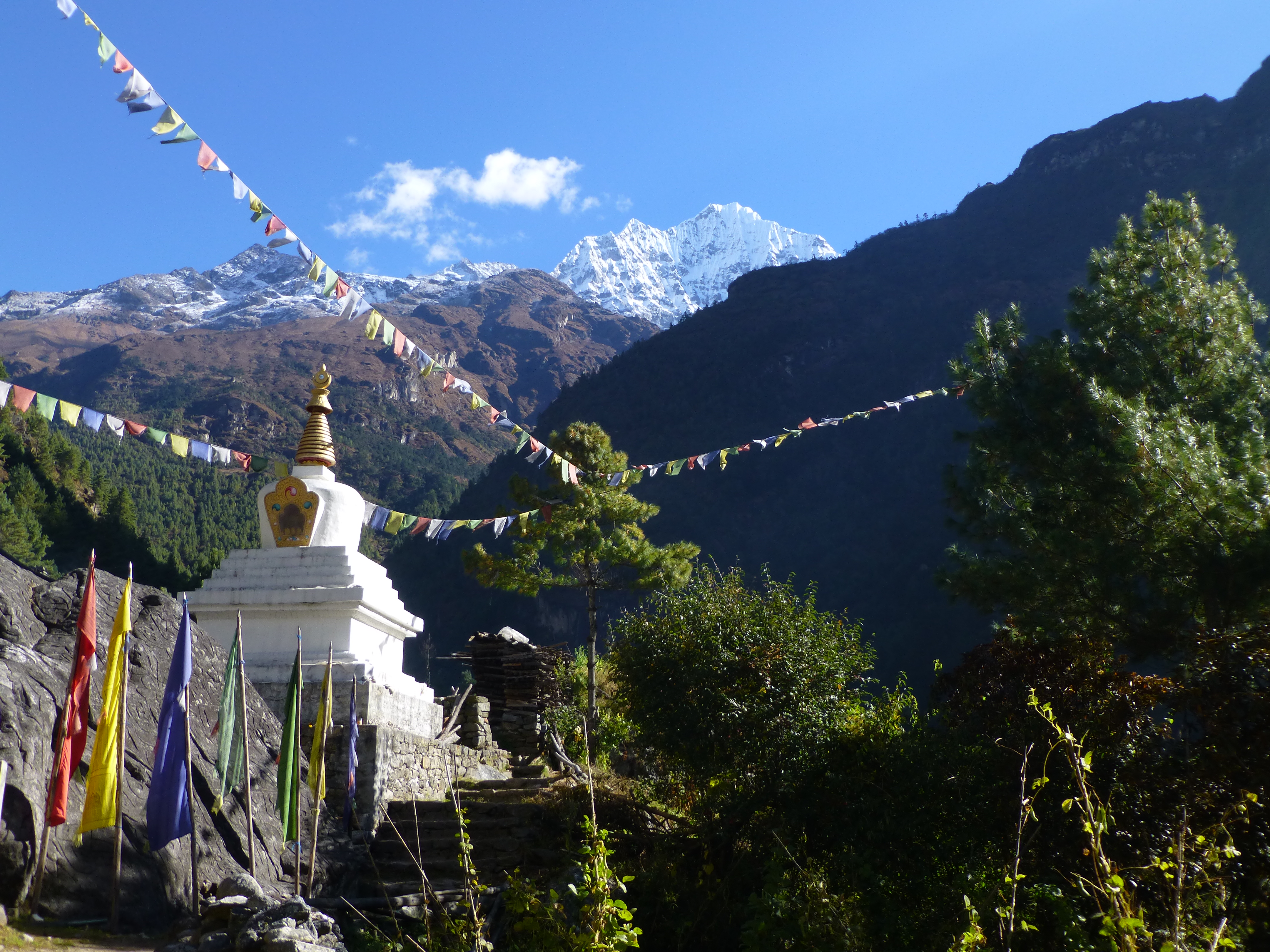
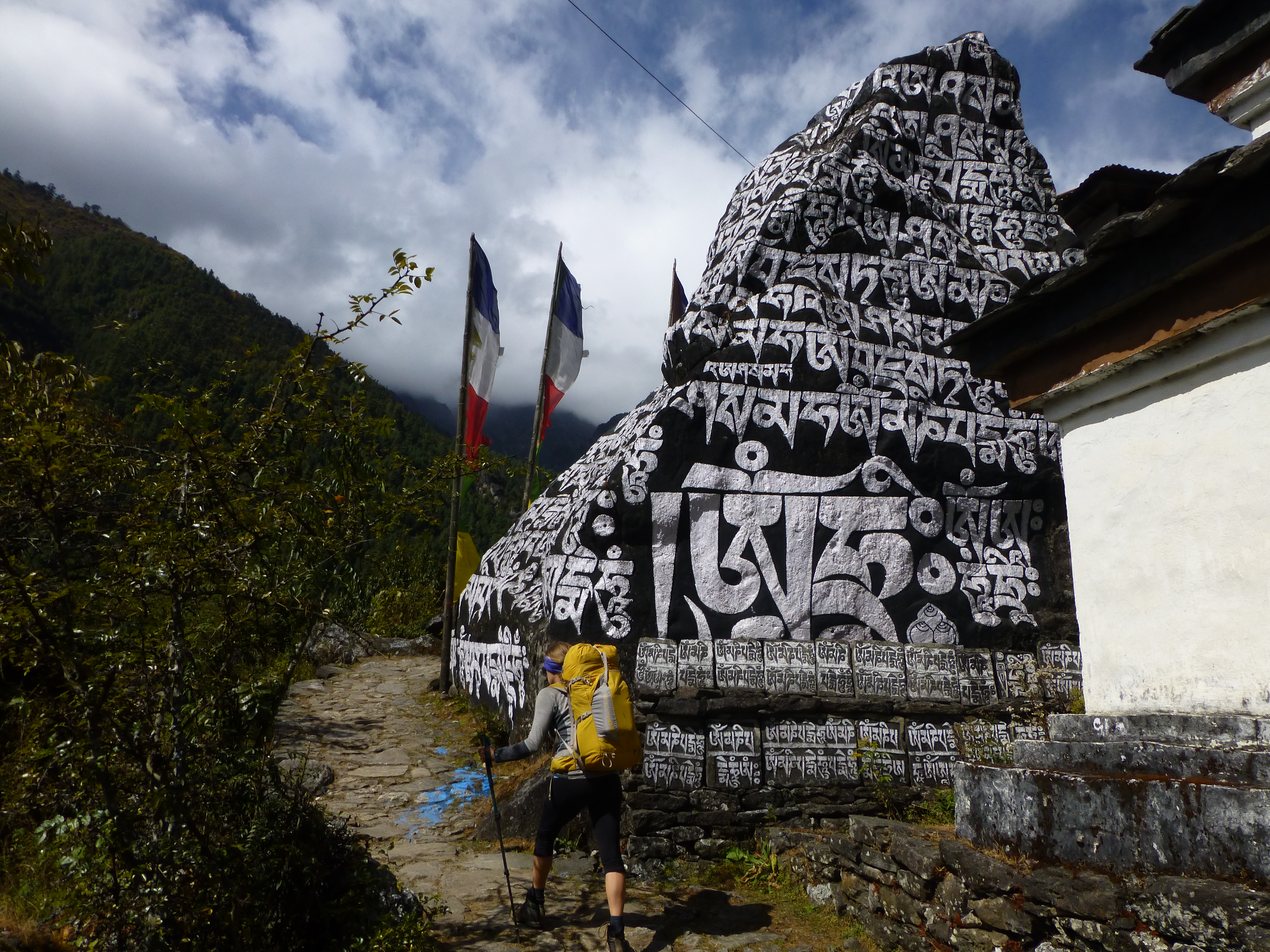
The town of Thame was nestled directly underneath the dramatic Kongde Ri mountains and was rich with history. The Buddhist monasteries, stupas, and chortens were a constant reminder of the sanctity of the space we were passing through. The mountain landscape and spirituality of the Solukhumbu mesh seamlessly to create an experience impossible not to be touched by.


Day 5: Thame (12,467′) to Marjung (12,959′)
After a restless night sleep, I woke up in the morning with a piercing headache. Despite being at a relatively low elevation, it was obvious he was suffering from acute mountain sickness (AMS). In addition to the debilitating headache, Adam was unreasonable fatigued, and nauseous.
Michelle tucked me back into bed for a few more hours, then we only managed a short, slow and unsteady 2 hour hike to Marjung.

The bright side to stopping for the day so early, was the luck of staying at the guesthouse of a sweet, welcoming and joyful Sherpa. He has been to the summit of Everest 10 times, stood on the top of several other 8,000 meter peaks, and roped up with Reinold Messner. It was motivating to hear some of his stories and relaxing to spend time with his humble, humorous nature.

Day 6: Marjung (12,959′) to Lumde (13,573′)
The overnight stop in Marjung was a slight hiccup in our itinerary, but it also proved beneficial. I was feeling stronger and we were able spend some additional time acclimatizing before we crossed the pass.
The short hike to Lumde was kind of like another rest day. It was, however, very cold at night and in the morning and that was starting to sap our energy reserves. We would have to get used to it. We would be at a high altitude for the next couple weeks.


Day 7: Lumde (13,573′) to Gokyo (15,748′) over Renjo La pass (17,929′)
Just before sunrise we headed out for one of the hardest walks of our lives. It was cold, loose, steep and seemingly never ending. On the upside, it was beautiful and challenging and we loved every minute of it. We walked from the valley floor, up through the alpine tundra, over rocks and snow and ice to reach Renjo La pass. Michelle tackled the trail with an unwavering tenacity and I just had to follow her lead. We staggered to the top, ducked under the strings of prayer flags and cast our eyes on one of the most magnificent views we’ve ever seen. Mount Everest may not be the most dramatic looking peak, but there is no denying how it commands the skyline. And what a skyline! Words simply can’t do it justice. We were in awe, looking out over Nepal and Tibet, staring at the highest mountains in the world.


I have to admit, seeing Mount Everest for the first time gave me butterflies. It made me realize just how far we had come on our adventure away from home. Within the panorama of peaks we could see our destination: the village of Gokyo on the shore of Gokyo Lake. It seemed impossibly far away as we slowly descended the east side of the pass and it didn’t seem to ever get closer.


It was late afternoon when we stumbled into Gokyo. On the trail up the pass we met a guy from Telluride (Coloradans are everywhere!) that recommended the Namaste Lodge, saying that Tenzing, the manager, loved people from Colorado. When we walked into the lodge we were greeted with warm mango-strawberry juice. We stayed for two days.
Day 8: Rest day in Gokyo (15,748′)
The following day we didn’t do anything except read our kindles, drink tea, chat with fellow trekker, play cards, eat, and sleep.
Really, the only significant thing that happened this day was we met Liz and George, a lovely couple from Australia. We chatted over dinner and tea and became quick friends. It is so insightful to learn foreigners impressions about the United States. Sometimes it seems that they are even more informed that we are.
Day 9: Gokyo (15,748′) to Thangnak (15,580′)
Our second day in Gokyo we planned to hike to the top of Gokyo Ri, a summit with a view of Everest. But, we were still tired and lazy. We wandered up the trail chatting, not feeling too ambitious. We stopped when we felt done, well below the top. We spent the rest of the morning reading and drinking tea.
By noon however, we knew we finally had to do something. We packed up and headed out across the Ngolumba Glacier. It was a relatively short distance hike, but walking over a glacier is no easy task. The ground literally feels alive under your feet. The ice and stone creek and groan as the glacier subtly moves. The trail twisted and turned through the complex terrain. If it weren’t for the rock cairns we would have never seen the path.


It took us a couple hours to finally reach Thangnak where we slept prepared ourselves for the next mountain pass looming ahead…
Love this? Read on about trekking in the Khumbu region of Nepal in parts two and three of our series.